VIS 2026VIS 2026 — Virtual Island Summit|Also: GSIS 2027GSIS 2027
Island Innovation Logo
About
Services
The Network
Events
Content Library
Contact Us

Subscribe to our newsletter. By submitting, you agree to our Privacy Policy.

Island Innovation

Island Innovation works with governments, institutions, and partners worldwide to support island-led sustainable economic development.

We Support The UN Development Goals

SDG 9: Industry, Innovation and Infrastructure
SDG 11: Sustainable Cities and Communities
SDG 12: Responsible Consumption and Production
SDG 13: Climate Action
SDG 14: Life Below Water
SDG 17: Partnerships for the Goals

Explore

AboutServicesNetworkEvents

Content

ArticlesNewsCareers

Ready to Connect?

Join the island innovation community

Get in Touch

About

  • About us
  • Case Studies
  • FAQs
  • Press
  • Careers
  • Contact

Services

  • Services Overview
  • Public & Media Relations
  • Strategic Communications

Network

  • The Island Network
  • Academic Council
  • Newsletter

Events

  • Our Events
  • Watch Past Events

Content

  • All Content Library
  • Videos
  • Articles
  • News
Privacy PolicyTerms of ServiceContactManage email preferences

© 2025 Island Innovation. All rights reserved.

    News

    Curated stories and analysis from islands and sustainability leaders worldwide.

    Filter by Core Theme

    All ThemesCircular EconomyClimate ActionConnectivity & DigitizationCulture & CommunityEnergy & TransportGreen Finance & EconomyOcean & BiodiversityPolicy & GovernanceTourism & Remote WorkWater & Food
    Showing 9 of 2195 news items
    A Robot Swarm Is On a Mission to Map Greenland’s Perilous Ice Sheets
    Climate ActionSeptember 17, 2026

    A Robot Swarm Is On a Mission to Map Greenland’s Perilous Ice Sheets

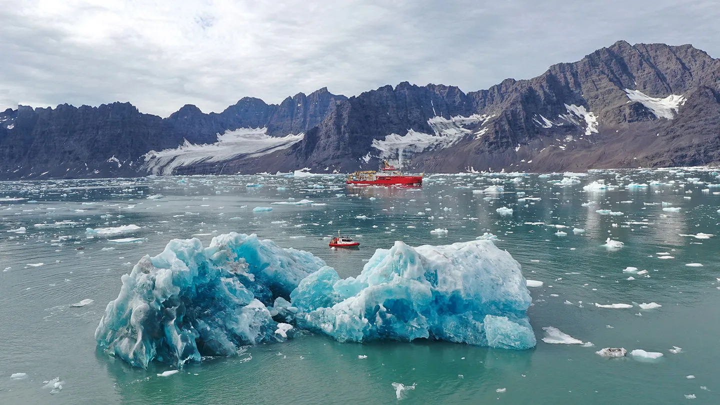
    This summer, in remote Greenland, a suite of high-tech gadgets and robots will be deployed, James Bond–like, at the treacherous points where glaciers meet the sea. Their mission: Study melting ice in never-before-seen detail. The data from the expedition, funded by the British government’s secretive new inventions agency, will feed into the latest climate models. The idea is to forecast when the ice melt will tip climate-regulating ocean currents into a shutdown, and try to develop an early warning system that would let humanity know when glaciers are changing in an alarming way. The voyage, launching on July 16, “addresses a foundational data deficit in one of the most consequential parts of the climate system,” says sea ice acoustics expert Hari Vishnu of the National University of Singapore, who isn’t involved in the work. “We cannot model what we cannot observe.” Until recently, such a mission would have been impossible. Where Greenland’s glaciers meet turbulent waters, “ice cliffs tower above the ocean surface — sometimes 30 meters high, sometimes a hundred — fracturing, collapsing and launching house-sized icebergs into the fjord with little warning,” says oceanographer Jonathan Nash of Oregon State University in Corvallis. Nash is a member of the project, which is named GIANT, for Greenland Ice sheet to AtlaNtic Tipping points from ice loss. Under the sea surface, Nash says, chaotic plumes and eddies rise and swirl. It’s difficult and dangerous for scientists to get instruments close enough to the key area of interest: the centimeters-thin boundary layer where ice meets ocean. The danger element, combined with the challenges and scale of collecting lots of different types of data from above, on and below ice all at once meant previous projects could work on only one aspect of the problem at a time, if at all. “We always wanted to create a project that could simultaneously observe and model all parts of this process,” says Paul Holland, an ice scientist at the British Antarctic Survey in Cambridge, England. So, when Holland and his colleagues saw a call for grant proposals from the U.K. government’s recently launched Advanced Research and Invention Agency, which backs high-risk projects, they jumped at it. The 20 million British pounds ($26 million) in funding comes at a time when uncrewed technology is becoming sophisticated enough to eavesdrop on ice at close range, traversing perilous waters and crumbling ice rocks without endangering researchers. “We’re in a moment where our tools have finally caught up with our questions,” says marine geophysicist Kelly Hogan of the British Antarctic Survey. “We can explore glacier-ocean interactions in ways that were unimaginable just a few years ago.” Climate models don’t account for intricacies of ice melt As Earth warms, Greenland is already losing several times more ice than it did just few decades ago. If enough freshwater from melting ice enters the ocean, it could topple vital ocean currents. One, the Atlantic Meridional Overturning Circulation, or AMOC, transports warm tropical waters northward before cooling, sinking and returning southward. An interruption of AMOC would make Europe colder and drier, and would also dramatically shift tropical monsoons, affecting agriculture and the food supply. “If the AMOC is a pot of warm, salty soup that’s flavored just right, then it’s like adding cold tap water to the pot. The Greenland icebergs ruin the soup,” says earth scientist Kristin Poinar of the University at Buffalo in New York, who is not involved with the expedition. “The AMOC relies on dense, salty ocean water to sink, and too much freshwater from icebergs will slow or stop that process.” Multiple lines of evidence suggest that the AMOC is already weakening. The actual shutdown of the current, and its impacts, would play out over decades or centuries, though there is still a lot of uncertainty. That’s in part because climate models have so far treated ice melt as a simple process — warm water arrives, heat is transferred and ice melts. They don’t account for the physical complexity of the environment where huge glaciers meet choppy seas. One such nuance is the tiny bubbles of ancient air trapped in glacier ice that are freed during melting and then rise along the ice face. They may intensify the mixing of the ice-ocean layer and drive more heat transfer. But they’ve been impossible to observe and thus to add to existing models. Though the bubbles are small, Nash says, they could have “considerable” implications for sea-level rise projections when multiplied across hundreds of glaciers. Heat transfer by such bubbles may also be one of the myriad similarly small but important drivers in iceberg calving events — when chunks of ice break off at the edge of a glacier or ice shelf and fall into the sea. Glaciers shed many icebergs into the ocean during some years and fewer in others, a phenomenon the mission’s data should help explain, Poinar says. The expedition’s planned millimeter-scale observations of phenomena such as bubbles, she says, will be “like watching a crack form in a windshield before it shatters.” The observations will feed into a climate model called the U.K. Earth System Model. It “is already a very good climate model, and it’s about to get even better,” Poinar says. The voyage “will give it an immediate upgrade, driven by brand new data from some of the most data-scarce places on Earth.” A flotilla of robots will fill in the details The mission will deploy a fleet of submarines, robots, drones and sensors from a mothership, the Royal Research Ship Sir David Attenborough, which itself is a floating laboratory. The vessel will spend much of July and August near the steep fjord glaciers of Kangerlussuaq in southeast Greenland. Next summer, measurements will take place at the Petermann glacier in Greenland’s northwest. Many of the robots are being tested in the field and tweaked on an ongoing basis to make them work as hoped, Holland says, so “reality is perhaps more experimental than you would see in [James Bond] films.” The ship will release rugged flying drones to study ice from above, at a closer range than the satellite data the team already gets. The drones are engineered to stay airborne when the weather turns hostile or when ground access collapses. The vessel’s helicopter will drop small sensors to measure changes on the surface of glaciers, terrain that is naturally booby-trapped with crevasses and ice streams. The sensors are essentially a GPS in a javelin. The javelins embed into the ice on one end and track the ice movement as the glacier melts, all while transmitting data to researchers from the antenna on the end that sits above the ice.
    12345678910
    Read more
    ʻUlu On The Up: Hawaiʻi Breadfruit Production Keeps Booming
    Water & FoodSeptember 17, 2026

    ʻUlu On The Up: Hawaiʻi Breadfruit Production Keeps Booming

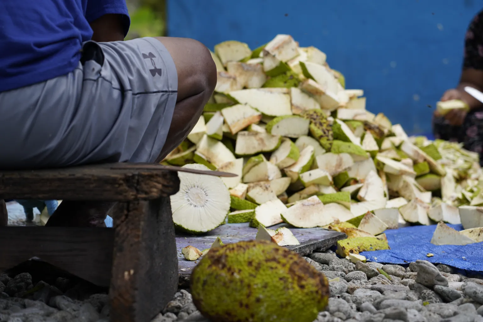
    Breadfruit production is growing in just about every way in Hawaiʻi, as more farmers plant more trees that are producing more fruit. The canoe crop, known as ʻulu, has experienced a renaissance for over a decade as Hawaiʻi residents have readopted the starchy staple. The cannonball-sized fruit has made it onto restaurant menus, public school meals and even into pancake mixes, flours and other ready-to-eat products. Supply has responded to demand, increasing by an average of 34% every year since 2017. That’s 212,000 pounds of ʻulu produced throughout the past fiscal year —13 times more than the Hawaiʻi ‘Ulu Cooperative’s production a decade ago, according to numbers from the cooperative and the Department of Agriculture and Biosecurity. This year’s devastating storms, associated with a potentially record-breaking El Niño, may result in a downturn as trees struggle. Still, the cooperative’s production is forecast to double by 2029 and more than quadruple by 2033, CEO Dana Shapiro said, as more of the members’ trees reach maturity, more trees are planted and more farmers get involved. The ʻulu cooperative’s membership has grown from 12 producers to 227 since 2017, with 50 added in the last year. Those members currently look after almost 10,000 trees. “Of that, about 60% are not what we would consider mature trees,” Shapiro said. “They’re still coming online.” Currently, given the varying ages of members’ trees, the average annual production is 21.6 pounds per tree. It can take about 10 years for ʻulu trees to reach maturity. Trees of the maʻafala variety of ʻulu produce 250 to 450 pounds of fruit annually. Even without planting more trees, Shapiro expects more fruit will be produced. But turbulent weather has winnowed much of this year’s crop at the height of harvest season, which can run from July to December. The Kona low storms in March and Lala in August had an adverse effect on trees, forcing them to drop developing fruit early, said Noa Kekuewa Lincoln, who runs the Indigenous Cropping Systems Laboratory at the University of Hawaiʻi. “Whether that’s the wind, or the tree stress or the flooding, clearly the storm systems have had a strong impact on the tree production,” Lincoln said. “I think we are going to see a dip this year… and we’re not even halfway through hurricane season.

    Read more
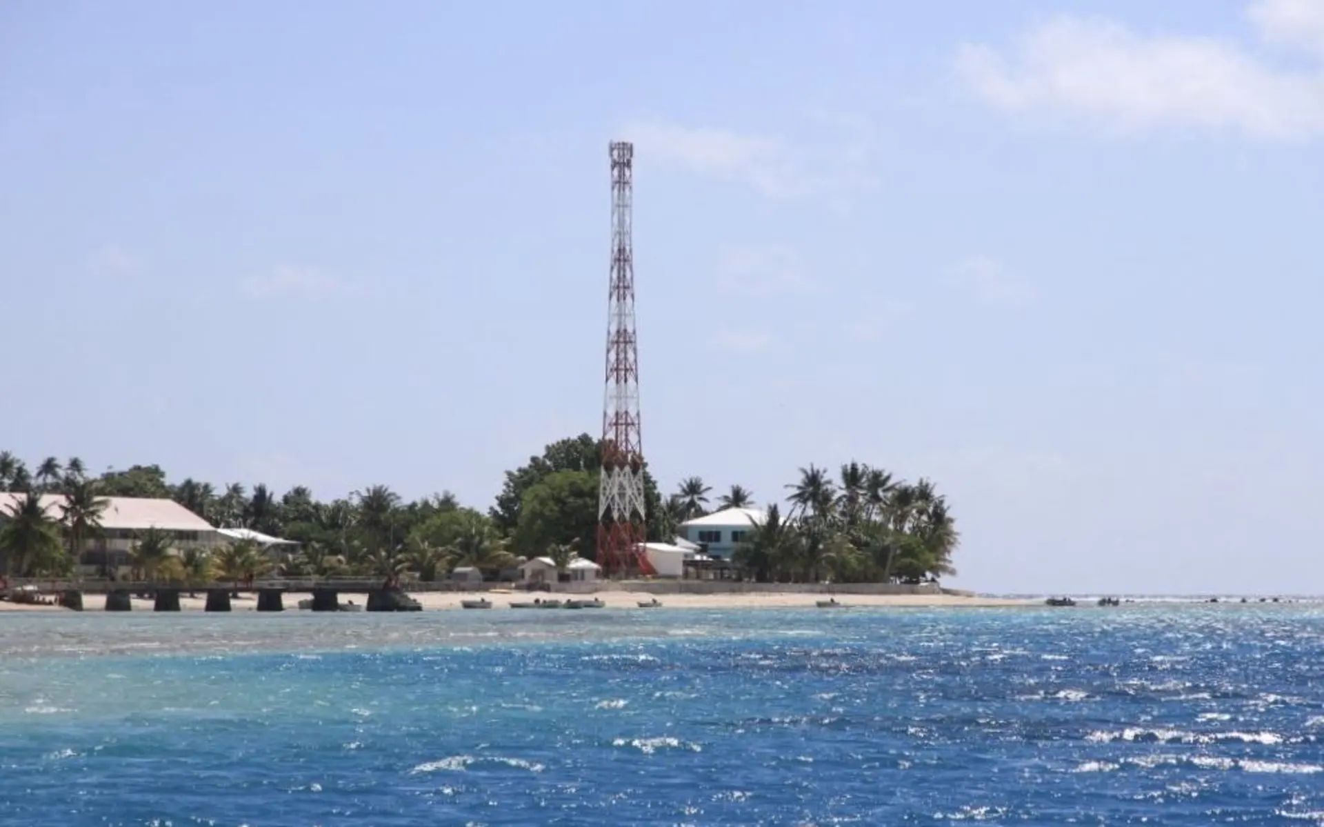
    Tokelauan Atoll Becomes Temporary Global Comms Hub
    Connectivity & DigitizationSeptember 17, 2026

    Tokelauan Atoll Becomes Temporary Global Comms Hub

    For two weeks in November the remote Tokelauan atoll of Fakaofo will become a global communications hub. The remote Tokelau atoll of Fakaofo is 3,380 to 3,790 kilometres northeast of New Zealand - the number of people who live on Fakaofo is just over 470. However, this tiny dot in the Pacific is one of amateur radio's most sought-after locations, and for two weeks in November will become a global communications hub. In amateur radio, "DX" comes from telegraph shorthand: "D" for distance and "X" for the unknown or distant. For about two weeks in November, DX enthusiasts from the Perseverance DX Group and the Western Washington DX Club will set up temporary stations on Fakaofo, giving radio operators around the world a rare chance to make contact with Tokelau. Tokelau's project coordinator, Aleki Silao, said the idea for the project came about following a request in 2024 from a group who were keen to travel to Tokelau, in particular Nukunonu, to link up with colleagues around the world through shortwave radio. However, Fakaofo was selected because of its greater remoteness and the challenge that connecting it to the world would pose. "And that's why this group expressed a special interest to bring their know-how and technology to Fakaofo for two weeks," Silao explained. Knowledge sharing The Fakaofo team plans to operate several stations from the 160-to-6-metre amateur bands using voice, Morse code and digital modes. When asked how the atoll will benefit from this project, Silao said it would be on numerous fronts. "They have agreed to a number of things, training to pass on their knowledge in terms of this technology, furthermore they have offered to give twenty laptops through which Fakaofo may set up some internet cafes or even how the locals can communicate with the outside world." For operators around the world, a confirmed contact with Tokelau is a prized achievement. For Fakaofo, that global interest creates an unusual opportunity to exchange access and welcome for equipment, learning and enduring relationships.

    Read more
    In Raja Ampat, Children Are Learning to Become Island Stewards
    Culture & CommunitySeptember 17, 2026

    In Raja Ampat, Children Are Learning to Become Island Stewards

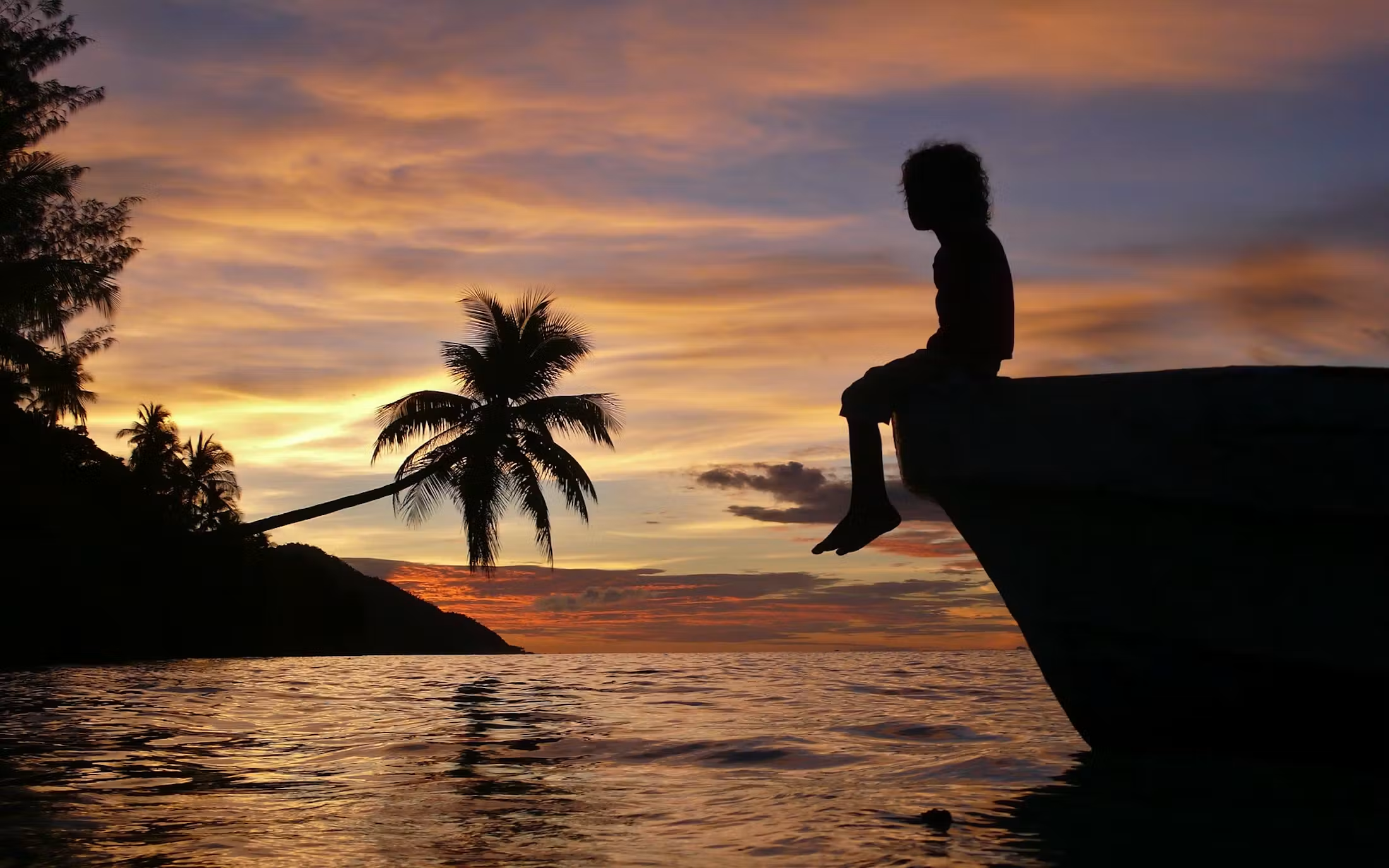
    “Rockhead fish, salamander fish, starfish and coral.” That’s what dozens of children from Arborek, a small island in Indonesia’s Raja Ampat archipelago, said when asked what they see in nature that is yellow and orange. The children rattled off the fish and other marine life they encounter when they play in the sea, during a reading of a children’s book about Raja Ampat and the threat of nickel mining. Research suggests that children who grow up closely connected to their surroundings can develop sophisticated understandings of their local environment. A 2014 study of children in 22 villages in Indonesian Borneo, for example, found that they recognised relationships among forests, rivers, wildlife and other environmental changes. So Sekar Bestari, the book’s illustrator, wasn’t surprised by the children’s answers. “Most of the time when we read the books to children, they understand them, so don’t underestimate children’s knowledge,” she said after the reading in Arborek. “We’re not surprised anymore today.” The reading was part of a three-day gathering of Indigenous communities in Arborek that brought together representatives from 20 Indigenous subtribes in Raja Ampat, as well as Indigenous people from other parts of Indonesia and abroad. The gathering, organised by Greenpeace Indonesia and local NGO Institut USBA, was intended to strengthen solidarity among Indigenous communities in protecting their lands, waters and biodiversity. The children’s knowledge of their surroundings also emerged in less expected ways. Titah Asmaning Winedar, the book’s author, recalled meeting a girl named Esther who told her there was a way to call sea turtles. “She said you just split open a coconut and leave it in the sea,” Titah said. For Titah and Sekar, such knowledge is part of what they hope the book will encourage children to value — and eventually to document and tell themselves. “When they see that a Raja Ampat story has been made into a book like this, our hope is that they feel, ‘Oh, my story is important too,’” Titah said. A story told through colours The book, titled Luka-Luka Pulau Kecil (The Wounds of Small Islands), tells the story of Pin, a child who loves swimming in the sea and lives in a stilt house surrounded by white sand. Pin loves rainbows because they are full of different colours, just like her home. She often thinks to herself, “Ah, the rainbow must have borrowed all its colours from its surroundings.” Colours are central to the story. For the people of Raja Ampat, Titah said, the colours of the natural environment are more than something beautiful to look at. They can represent the health of the islands and their biodiversity. “I realised this from looking at photos and snorkelling videos from Raja Ampat,” she said. “I thought, ‘Wow, it’s so colourful.’” She then asked two Greenpeace volunteers from Raja Ampat what kinds of plants and animals they encountered around their homes. They mentioned flowers and other colourful elements of the landscape. Rainbows also frequently appear in Raja Ampat, Titah said. Raja Ampat lies in the heart of the Coral Triangle and is one of the world’s most biodiverse marine regions. Researchers have estimated that its waters contain about 75% of the world’s known coral species. The book turns that biodiversity into a visual story about what could be lost if mining damages the environment. One day, while Pin is happily playing, she hears a rumbling sound from the sea. It turns out to be a giant barge carrying several huge excavators. The next day, the rainbow appears without its red colour, obscured by smoke from the mining activity. At the same time, Pin sees a red hibiscus flower wilting, a bird-of-paradise becoming weak and red coral dying. As mining continues, the colours of the rainbow — and the plants and animals they represent — disappear one by one. “Are you sad if the marine animals disappear?” Sekar asked the children. “Very sad,” they responded. Nickel’s return to the conversation The story comes as Raja Ampat remains at the centre of a debate over nickel mining. Nickel, used primarily in stainless steel and increasingly in some electric vehicle batteries, has become a major commodity for Indonesia. The country’s nickel mine production rose from about 130,000 metric tons in 2015 to 2.2 million metric tons in 2024, according to the US Geological Survey, making Indonesia by far the world’s largest producer. Most of Indonesia’s nickel mining is concentrated in Sulawesi and North Maluku. But several islands in Raja Ampat have also been targeted for mining. Public concern over nickel mining in Raja Ampat erupted in 2025 after images of forest clearing and environmental damage were widely shared on social media. The backlash prompted the government to suspend mining operations and later revoke four of the region’s five nickel mining permits. The remaining operation, the state-owned PT Gag Nikel, continues to mine on Gag Island. Greenpeace says the government actions have not eliminated the threat of future mining in the archipelago. Its latest research identifies two companies seeking to develop nickel projects in eastern Waigeo, Raja Ampat’s largest island, and another company seeking a coal permit in Misool. Greenpeace had initially described three companies as pursuing nickel projects but issued a clarification in August 2026 saying that one of the three was actually seeking a coal permit. Waigeo is home to endemic wildlife including Wilson’s bird-of-paradise (Cicinnurus respublica), the Waigeo brushturkey (Aepypodius bruijnii) and the Waigeo spotted cuscus (Spilocuscus papuensis). Residents of Arborek say they are concerned that mining elsewhere in Raja Ampat could affect the waters and ecosystems on which communities across the archipelago depend. Benoni Watem, a 43-year-old resident of Arborek and an owner of a homestay business, said he firmly rejects mining in Raja Ampat, because it could harm the beauty of the ecosystem, which is one of the main reasons why tourists come to the region. Arborek is the closest village to the famed Manta dive and snorkeling sites. “The beauty of Raja Ampat is what brings tourists here. But if mining comes in, the environment that we have protected will be damaged by mining, and then the beauty will disappear,” Benoni said. He’s worried that waste from mining will end up in the ocean and ultimately kill marine life, such as manta rays — the largest species of all rays that are threatened with extinction due to their slow reproductive rates and large number of threats. “Manta rays might become uncomfortable. If waste enters the sea, their food will disappear,” Benoni said. “When there are manta rays, guests get excited and happy.” The concern is not only for wildlife. George Mentansan, an anthropologist who spoke at the Arborek gathering, said environmental damage could also threaten the cultural diversity of Raja Ampat. Indigenous communities have developed their own systems for managing natural resources, including ecological calendars, areas protected by customary rules and restrictions on catching certain marine species.

    Read more
    Kiribati’s Line Islands Mapped to Bolster Climate Resilience
    Climate ActionSeptember 17, 2026

    Kiribati’s Line Islands Mapped to Bolster Climate Resilience

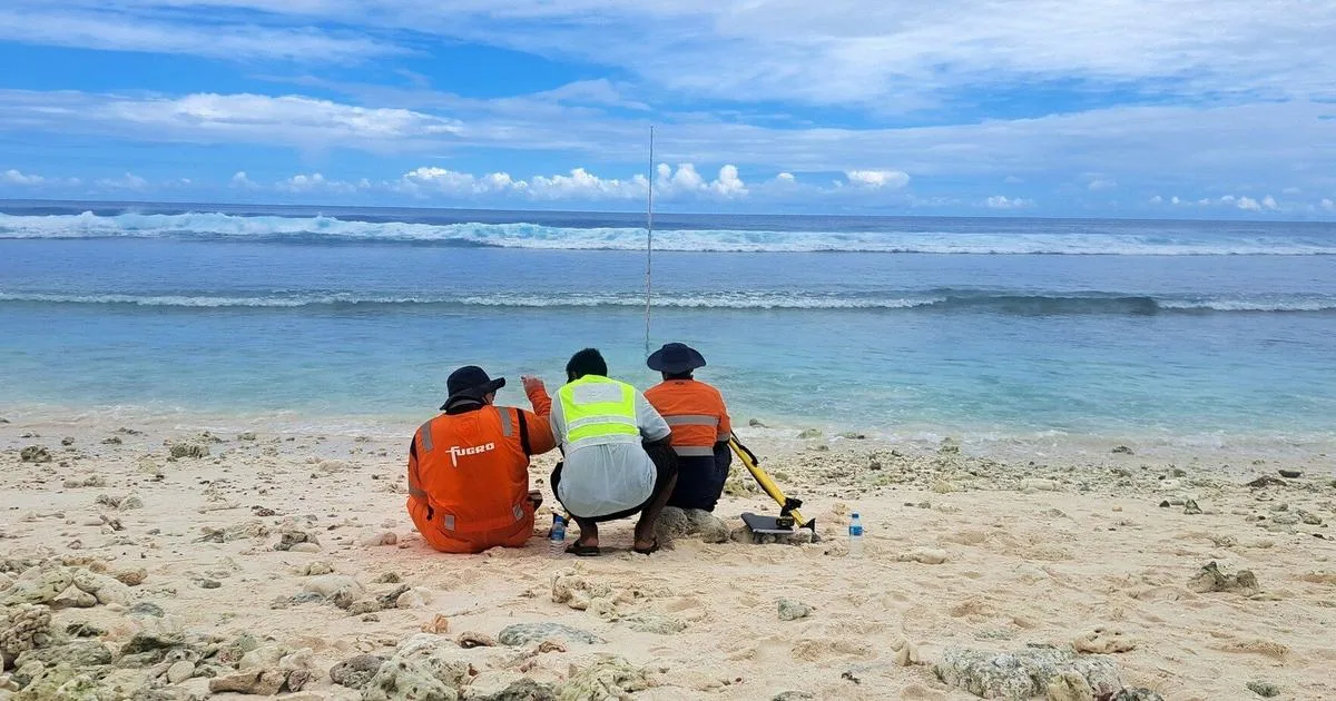
    Fugro has completed high-resolution coastal mapping and ground survey work across Kiribati's remote Line Islands, providing essential Geo-data to support climate-resilient planning, infrastructure development, and environmental management. The work was carried out in support of the Kiribati Outer Islands Resilience and Adaptation Project, known as KOIRAP, led by the Ministry of Culture and Internal Affairs and funded through the World Bank-supported KOIRAP program. The project supports the Government of Kiribati’s efforts to strengthen climate resilience and improve understanding of coastal processes, flood exposure, and environmental change across the Line Islands. Operating across the atolls of Kiritimati, Tabuaeran and Teraina, Fugro used its RAMMS® airborne LiDAR and imaging system to acquire high-resolution coastal and topographic data. The airborne survey was supported by extensive ground control activities, including survey control points, Global Navigation Satellite System observations, and tide gauge installations, helping ensure the accuracy and long-term value of the datasets. The resulting Geo-data will provide a trusted foundation for future studies, coastal resilience programs, and evidence-based decision-making across Kiribati’s Line Islands. It will help government agencies and communities better understand coastal change, assess climate-related risks, and plan for the impacts of sea-level rise. Mr. Manikaoti Timeon, Project Manager of the Kiribati Outer Island Resilience and Adaptation Project, said: “With the Government of Kiribati’s long-term aim to develop Kiritimati as a secondary economic hub to South Tarawa, we must have the necessary baseline data to ensure that our development takes adequate account of natural hazards and climate change, especially sea-level rise. The high accuracy of the LiDAR dataset collected by Fugro enables this, and will allow us to carry out a robust assessment to ensure resilience and adaptation are adequately accounted for.”

    Read more
    The Netherlands Establishes EU Platform for Curaçao and Other Caribbean Islands
    Policy & GovernanceSeptember 17, 2026

    The Netherlands Establishes EU Platform for Curaçao and Other Caribbean Islands

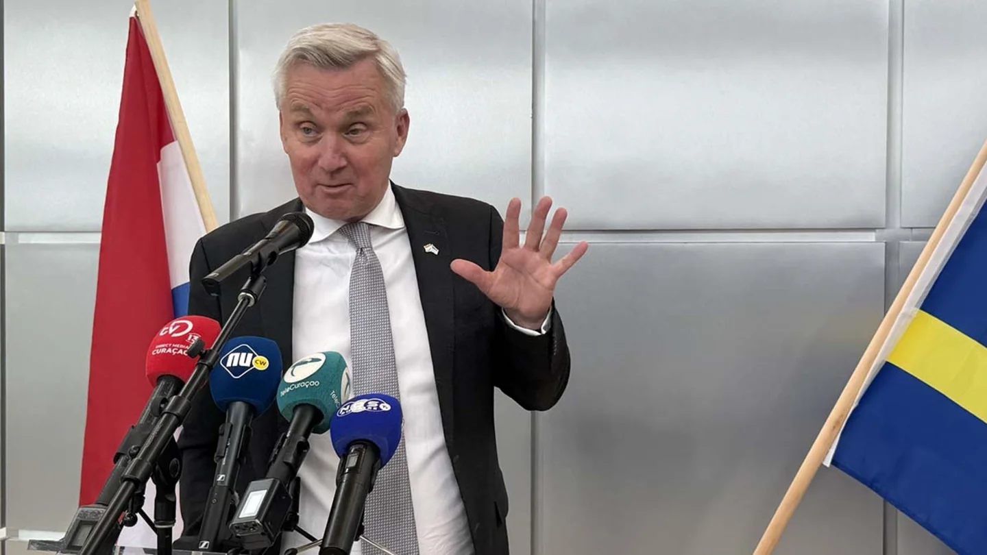
    The Netherlands is working on a joint EU platform for Curaçao, Aruba, Sint Maarten, Bonaire, Sint Eustatius, and Saba, together with the European Netherlands. The platform aims to make cooperation with Brussels more structured and to better support the islands in utilizing European subsidies and investment opportunities. State Secretary Eric van der Burg of the Interior and Kingdom Relations wrote this to the House of Representatives on Monday. According to him, more cooperation and coordination within the Kingdom are needed to act more effectively in Brussels. According to the Cabinet, a major problem is that while the islands do have access to European programs, in practice they are not always able to make full use of them. The implementation capacity of the Overseas Countries and Territories (OCTs) is relatively limited, meaning that participation in, for example, the European Global Gateway Strategy is formally possible but often difficult to implement in practice. Furthermore, not all available European funds from the current budget period have been utilized yet. The Netherlands therefore also wants to make more support available for the development of projects. A special legation has already existed for Bonaire, Sint-Eustatius, and Saba since 2023. Its activities are further focused on assisting in attracting European subsidies. The new EU platform aims to broaden cooperation to all six Caribbean countries and islands within the Kingdom with Overseas Countries and Territories (OCT) status. At the same time, the Netherlands is trying to expand the islands' access to European funds. Under the original proposal for the new EU Global Europe program, the OCTs could only draw from the global funding pot. This represents approximately six percent of the available resources within that program. Partly at the insistence of the Netherlands, the provisional position of the European Council includes the provision that Overseas Countries and Territories (OCTs) must also be granted access to funds from other geographical funds for regional and cross-border projects. This is not yet final. Negotiations on the European multiannual budget for 2028-2034 will continue at least until the end of this year and possibly into 2027.

    Read more
    Strengthening Transport Connectivity Across Orkney’s Island Communities
    Energy & TransportSeptember 17, 2026

    Strengthening Transport Connectivity Across Orkney’s Island Communities

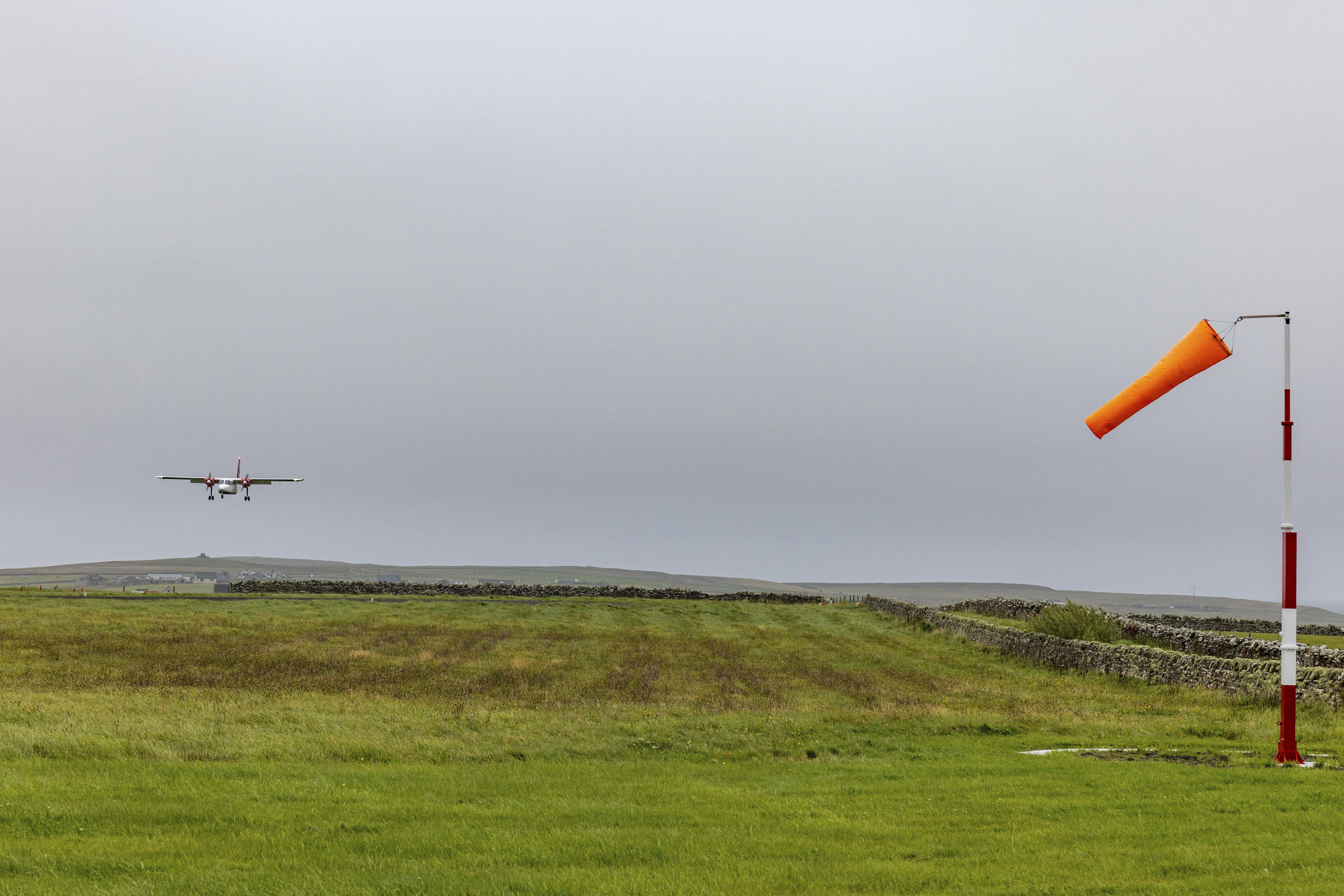
    For island communities, transport is far more than a means of travelling from one place to another. It is a fundamental component of sustainable communities, supporting access to healthcare, education, employment, essential services and economic opportunity. Reliable transport connections help people remain connected with family, friends and wider support networks while enabling businesses and public services to operate effectively. In Orkney, maintaining these vital links presents unique challenges. The geography of the archipelago means that ferry and air services provide lifeline connections between islands, requiring significant ongoing investment to ensure services remain reliable, accessible and resilient. Heather Woodbridge is the leader of Orkney Islands Council. She said: “In recent years, collaboration between Orkney Islands Council and the Scottish Government has helped strengthen the foundations for future transport connectivity. Through revenue and capital funding, support for the Ferries Taskforce, investment in infrastructure and backing for the Ferry Replacement Programme, progress has been made towards developing a more sustainable and resilient transport network for island communities. “This support has come at an important time. Like many island authorities, Orkney operates transport services that are essential to residents but costly to maintain. The inter-island ferry fleet is ageing, air services are experiencing rising demand, and communities require transport systems that can continue to meet changing needs into the future.” Recognising these challenges, a recent allocation of £2m in capital funding from the Scottish Government has enabled a programme of strategic investments aimed at strengthening resilience across Orkney’s transport network. These include the purchase of a Britten-Norman Islander aircraft for the inter-island air service, the acquisition of the MV Toplander to support ferry operations, and investment in equipment to assist with airfield maintenance. The acquisition of an additional aircraft is expected to enhance the resilience and capacity of Orkney’s inter-island air service. For many of the outer islands, air travel provides an essential connection to healthcare, education and other public services. Communities including North Ronaldsay and Papa Westray rely heavily on these links. Increased capacity and improved operational flexibility will help support service reliability while creating opportunities for more responsive scheduling and future service development. Alongside aviation investment, funding has also enabled the purchase of the MV Toplander. Although not a replacement passenger ferry, the vessel provides additional operational resilience within the wider network. It supports freight movements and can help maintain continuity of service during vessel breakdowns, maintenance periods or refits. With much of the existing fleet reaching an advanced age, resilience measures of this nature play an increasingly important role in sustaining island connectivity. Investment has also been directed towards supporting airfield infrastructure across the North Isles. A new runway roller will assist local teams in carrying out maintenance work more efficiently, helping licensed airfields continue to meet required safety standards while improving operational independence. While these projects provide immediate benefits, the long-term focus remains on fleet renewal through the Ferry Replacement Programme, one of the most significant infrastructure programmes undertaken by Orkney Islands Council. Many vessels currently operating within the internal ferry network are more than 35 years old, increasing maintenance requirements and placing greater pressure on service reliability. The Ferries Taskforce, established in 2022, has played a key role in bringing together the Council and Scottish Government to develop an approach to fleet renewal. Funding support has enabled work to progress on business case development, vessel design, operational planning and funding arrangements, helping move the programme from concept towards delivery. A significant milestone was reached when additional flexibility was introduced to inter-island connectivity funding arrangements, helping create a more sustainable financial framework for investment in replacement vessels while maintaining essential services. Further progress was achieved through confirmation of funding support for Phase 1 of the Ferry Replacement Programme.

    Read more
    Islands Tap Energy From Oceans’ Thermal Layers
    Energy & TransportSeptember 17, 2026

    Islands Tap Energy From Oceans’ Thermal Layers

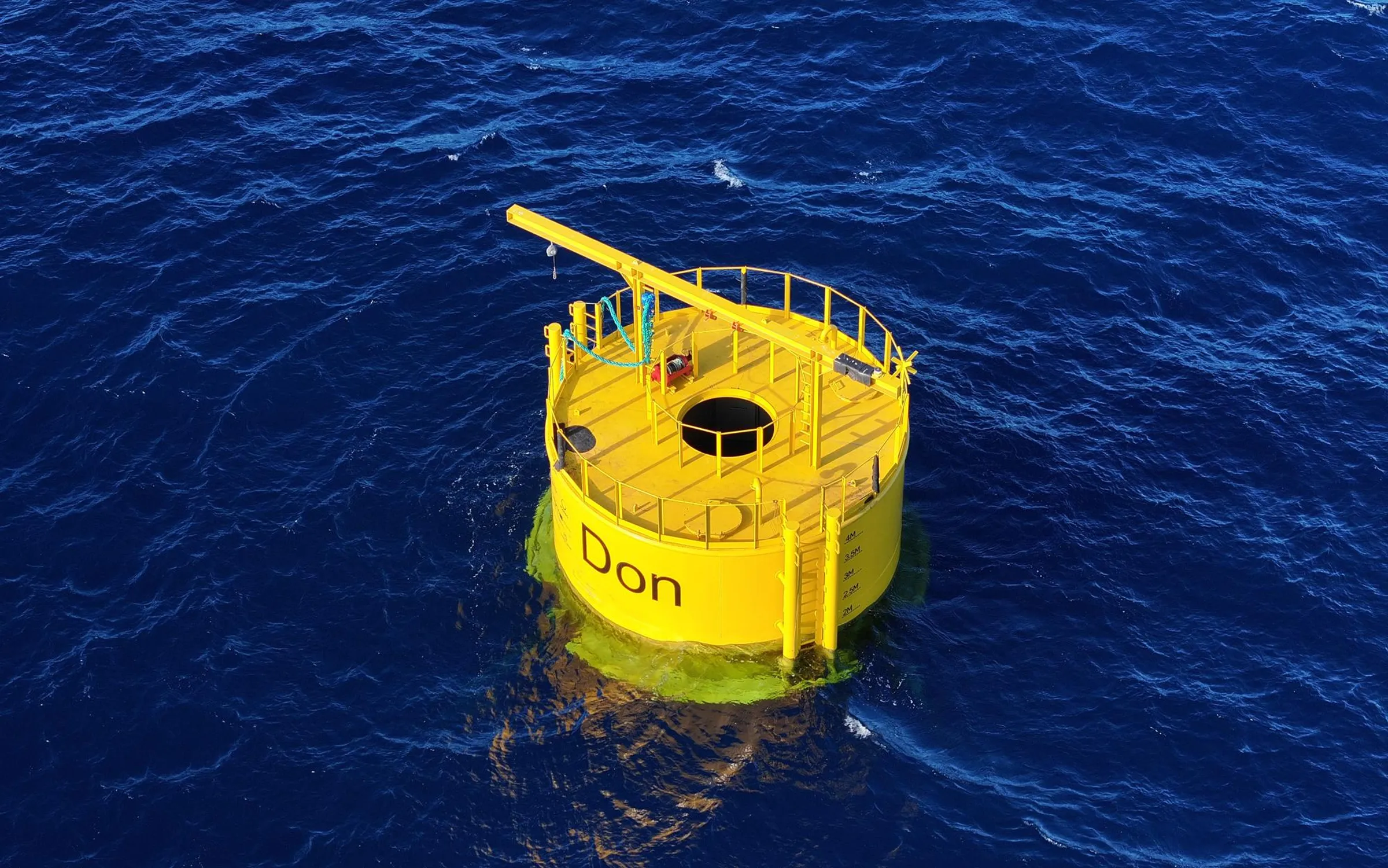
    Construction underway on a remote island nearly 400 kilometers west of India’s mainland could demonstrate, for the first time, the commercial viability of a vast, untapped renewable resource: the ocean’s thermal layers. Here, on the Lakshadweep Archipelago, surface waters are more than 20 °C warmer than the depths below, and with the right equipment that temperature differential can be exploited to generate electricity. Known as ocean thermal energy conversion, or OTEC, such power plants can deliver renewable power around the clock. The scale of the opportunity is immense thanks to extensive regions of the world’s oceans with sufficiently large temperature differences between surface and deep waters. In just the waters around the United States, for example, OTEC could satisfy the country’s entire power demand, according to a 2021 report by the U.S. Department of Energy’s National Laboratory of the Rockies. India’s project will tap 1,000-meter-deep seawater to generate 65 kilowatts of electricity and produce 100,000 liters of potable water per day. Developed by India’s National Institute of Ocean Technology (NIOT), it’s a small project, but a big step toward a commercial breakthrough for OTEC. “What we are doing is scalable in numbers for islands and remote communities. This can be a market strategy,” says Purnima Jalihal, who led the project before retiring last year as head of the energy and freshwater division at NIOT. The project is part of a fresh wave of enthusiasm behind OTEC. Kilowatt-scale projects have been completed recently in China and the Canary Islands, and more are planned for Hawaii, Taiwan, and Japan. While previous efforts to commercialize OTEC have come up short amidst engineering snafus, efficiency shortfalls, and funding constraints, today’s efforts benefit from advances in key devices and engineering capacity. Still, far bigger projects are needed before investment in OTEC will take off, says Robert Varley, who led defense contractor Lockheed Martin’s OTEC program from 2006 to 2017. Most OTEC proponents agree, saying the field needs a demonstration of at least a few megawatts, which is an order of magnitude larger than the longest-running projects to date. “Once that happens, I think the world changes for OTEC,” Varley says. How Ocean Thermal Energy Conversion Works Earth’s oceans absorb much of the sun’s daily irradiation and excess heat trapped in Earth’s atmosphere. But most of this thermal energy stays within 100 meters of the ocean’s surface. The deep seas remain frigid, dominated by meltwater from Earth’s frozen poles. Since the 1970s, a few dozen projects have sought to harness that heterogeneity. It’s challenging because the temperature gap the technology aims to exploit is relatively narrow. Even in tropical zones, most OTEC plants will have to make do with a 25 °C difference between the surface waters and the cold waters 1,000 meters below. (By contrast, conventional thermal generators function off of a 400 °C temperature spread.) To harness the small temperature differential, most groups generate power by heating and cooling a working fluid that naturally boils at a low temperature, such as ammonia. Surface water is pumped into the plant, and its heat is transferred to the ammonia, causing it to evaporate. That vapor then drives a turbine to generate power. Finally, to repeat the cycle, the ammonia’s heat is transferred to cold water piped in from the deep, causing the ammonia to condense. Squeezing power from a meager temperature delta requires a lot of surface and deep water. A 6.4-MW OTEC plant proposed on Taiwan’s east coast by Taipei-based industrial conglomerate TCC Group Holdings would suck up to 9,500 liters of cold seawater per second from 600 meters below the surface. A 10-MW design Lockheed envisioned for installation in China in 2013 would have processed 40,000 liters of seawater per second, but it was never built. Pumping on that scale favors placing plants on offshore platforms, which shortens the pipes required since they can extend straight down to reach lower depths. But offshore platforms increase costs, and operating in punishing open ocean conditions increases risk. When filled with water, an offshore OTEC platform’s dangling cold water pipe will weigh tens of thousands of metric tons, and any movement from rough seas will place immense stress on its connection to the platform. To address one of the risks of being located offshore, London-based startup Global OTEC deployed in the Canary Islands the world’s first platform purpose-built for OTEC and hurricane readiness. The platform, floated in April and paid for by government grants, is a 1:7-scale, non-working model of a 2.5-MW demonstration plant. An operating plant will be required to convince investors of the technology’s reliability. Jacobus, Pennsylvania-based Sea Solar Power, established in 1972 to pursue OTEC, is designing a 25-MW plant that it vows would satisfy investors by paying for itself if its electricity serves an island grid reliant on expensive diesel power. Sea Solar president James H. Anderson Jr. says his firm survived to date thanks to revenues from its manufacturing spinoffs, but he says the company is now seeking a US $5–10 million investment to finish the plant’s “pre-feasibility” engineering design. Building the plant would cost at least US $120 million more.

    Read more
    Harnessing The Blue Economy For Growth And Prosperity: The Cabo Verde Experience
    Green Finance & EconomySeptember 10, 2026

    Harnessing The Blue Economy For Growth And Prosperity: The Cabo Verde Experience

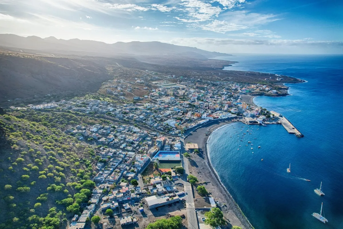
    As a small island nation surrounded by the Atlantic ocean, Cabo Verde has long understood that our ocean is not just a geographical reality—it is our greatest opportunity. The sea that once symbolized isolation now represents connection, resilience, and prosperity. Harnessing the blue economy (i.e., economic activities taking place below, on, or adjacent to the ocean)1 for sustainable development is central to Cabo Verde’s vision for the future and integral to the broader African agenda for inclusive, climate-resilient growth. For Cabo Verde, embracing the potential of the blue economy is not just an innovative development concept but a core national strategy. Our ocean covers an area over 200 times larger than our land mass, and it holds vast potential for renewable energy, sustainable fisheries, maritime transport, tourism, and innovation.2 Seizing this potential demands intentional, responsible stewardship and the steadfast commitment to long-term investment in our marine resources.3 Sustainability—in all its forms—is at the heart of our blue economy focus. Cabo Verde is investing in marine spatial planning, protecting biodiversity, and strengthening climate adaptation across coastal communities. Our approach seeks to balance economic use with environmental protection, ensuring our precious ocean resources can continue to support livelihoods and resilience for generations to come. In this context, the innovative debt-for-climate-and-environment swap between Portugal and Cabo Verde stands as a landmark achievement.4 Thanks to this innovation, part of Cabo Verde’s bilateral debt to Portugal has been converted into a climate and environmental fund to support renewable energy, marine conservation, and climate adaptation projects. This mechanism demonstrates how creative financial instruments can simultaneously strengthen fiscal sustainability and accelerate investment in the blue economy. It also reflects the spirit of partnership and solidarity that underpins Cabo Verde’s relationship with Portugal—a partnership that is political, economic, cultural, and deeply human. As this new agreement indicates, success is not built in isolation. Cabo Verde’s progress has been possible thanks to partnerships with international institutions and stakeholders, including the World Bank, the African Development Bank, the European Union, the United Nations, and bilateral partners. Together, we are working to mobilize financing, strengthen capacity, and share knowledge for sustainable ocean management. We also engage actively in regional and global forums, because small island states must not stand on the sidelines of global ocean governance: We must be at its center. The blue economy is also about economic diversification and job creation. For Cabo Verde, it represents a pathway to reduce dependence on tourism and imports while expanding opportunities in new sectors such as sustainable and regenerative aquaculture, maritime logistics, renewable energy, and digital services. The development of sustainable ports, green shipping, and digital connectivity are key priorities. We are hopeful that these investments will create decent jobs, especially for youth and women, and build resilience against external shocks.5 Looking ahead, Cabo Verde’s vision is to become a true “Ocean Corridor”—a hub that connects Africa, Europe, and the Americas through the Atlantic. Our geographic location gives us a natural comparative advantage for air and maritime connectivity, data and communication cables, and renewable energy networks. We aim to transform Cabo Verde into a logistics and digital hub, a bridge between continents, and a center for knowledge and innovation in the blue economy.The boldness of this vision requires continued commitment to good governance, private sector engagement, and regional cooperation. It also demands that we see the ocean not as a frontier to exploit but as a system to protect and sustain. Ocean sustainability is not an environmental luxury; it is an economic necessity and a moral obligation. As we look to 2026 and beyond, Cabo Verde remains committed to deepening its role in advancing the African blue economy agenda. We will continue to promote innovative financing, inclusive governance, and responsible ocean stewardship.

    Read more