VIS 2026VIS 2026 — Virtual Island Summit|Also: GSIS 2027GSIS 2027
Island Innovation Logo
About
Services
The Network
Events
Content Library
Contact Us

Subscribe to our newsletter. By submitting, you agree to our Privacy Policy.

Island Innovation

Island Innovation works with governments, institutions, and partners worldwide to support island-led sustainable economic development.

We Support The UN Development Goals

SDG 9: Industry, Innovation and Infrastructure
SDG 11: Sustainable Cities and Communities
SDG 12: Responsible Consumption and Production
SDG 13: Climate Action
SDG 14: Life Below Water
SDG 17: Partnerships for the Goals

Explore

AboutServicesNetworkEvents

Content

ArticlesNewsCareers

Ready to Connect?

Join the island innovation community

Get in Touch

About

  • About us
  • Case Studies
  • FAQs
  • Press
  • Careers
  • Contact

Services

  • Services Overview
  • Public & Media Relations
  • Strategic Communications

Network

  • The Island Network
  • Academic Council
  • Newsletter

Events

  • Our Events
  • Watch Past Events

Content

  • All Content Library
  • Videos
  • Articles
  • News
Privacy PolicyTerms of ServiceContactManage email preferences

© 2025 Island Innovation. All rights reserved.

    News

    Curated stories and analysis from islands and sustainability leaders worldwide.

    Filter by Core Theme

    All ThemesCircular EconomyClimate ActionConnectivity & DigitizationCulture & CommunityEnergy & TransportGreen Finance & EconomyOcean & BiodiversityPolicy & GovernanceTourism & Remote WorkWater & Food
    Showing 9 of 2195 news items
    Greenland Glacier Break Creates New Ice Island
    Climate ActionAugust 20, 2026

    Greenland Glacier Break Creates New Ice Island

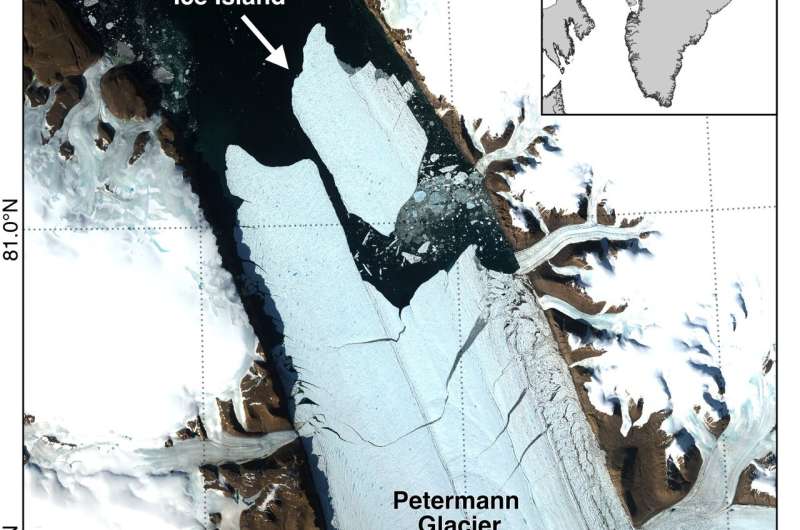
    An international research team partly led by the University of Ottawa reports that Petermann Glacier in northwest Greenland calved a 76.4 km² (29.5 square miles) ice island on Aug. 4, 2026, marking the glacier's largest loss of floating ice since 2012 and the largest Arctic calving event since 2020. The newly formed tabular iceberg detached from the glacier's floating ice tongue and is estimated to be up to 150 meters (492 feet) thick. With a surface area roughly comparable to Manhattan Island, the ice island offers scientists a rare opportunity to study how large Arctic ice masses form, drift and break apart over time. The event was detected by Adam Garbo, a doctoral student in glaciology at uOttawa's Department of Geography, Environment and Geomatics, as part of ongoing collaborations among the University of Ottawa, the University of Stirling, Environment and Climate Change Canada, Lancaster University and the University of Leeds. Years of monitoring helped researchers anticipate the break The calving event was detected through long-term satellite monitoring that has tracked changes at Petermann Glacier since 2019. Researchers have been following the glacier's floating ice tongue, documenting the growth of fractures and monitoring signs of instability over several years. "Petermann Glacier has long been one of Greenland's largest remaining ice tongues," says Garbo. "We've anticipated this break for years, and seeing it finally happen is remarkable." Satellite imagery from the European Space Agency's Sentinel-1 mission showed clear deterioration along the centerline of the ice tongue on Aug. 3. By 20:00 UTC on Aug. 4, the new ice island had detached from the eastern side of the glacier.

    12345678910
    Read more
    Restoration, Protection Aim to Save Belize’s Coral Reef From Extreme Heat and Disease
    Ocean & BiodiversityAugust 20, 2026

    Restoration, Protection Aim to Save Belize’s Coral Reef From Extreme Heat and Disease

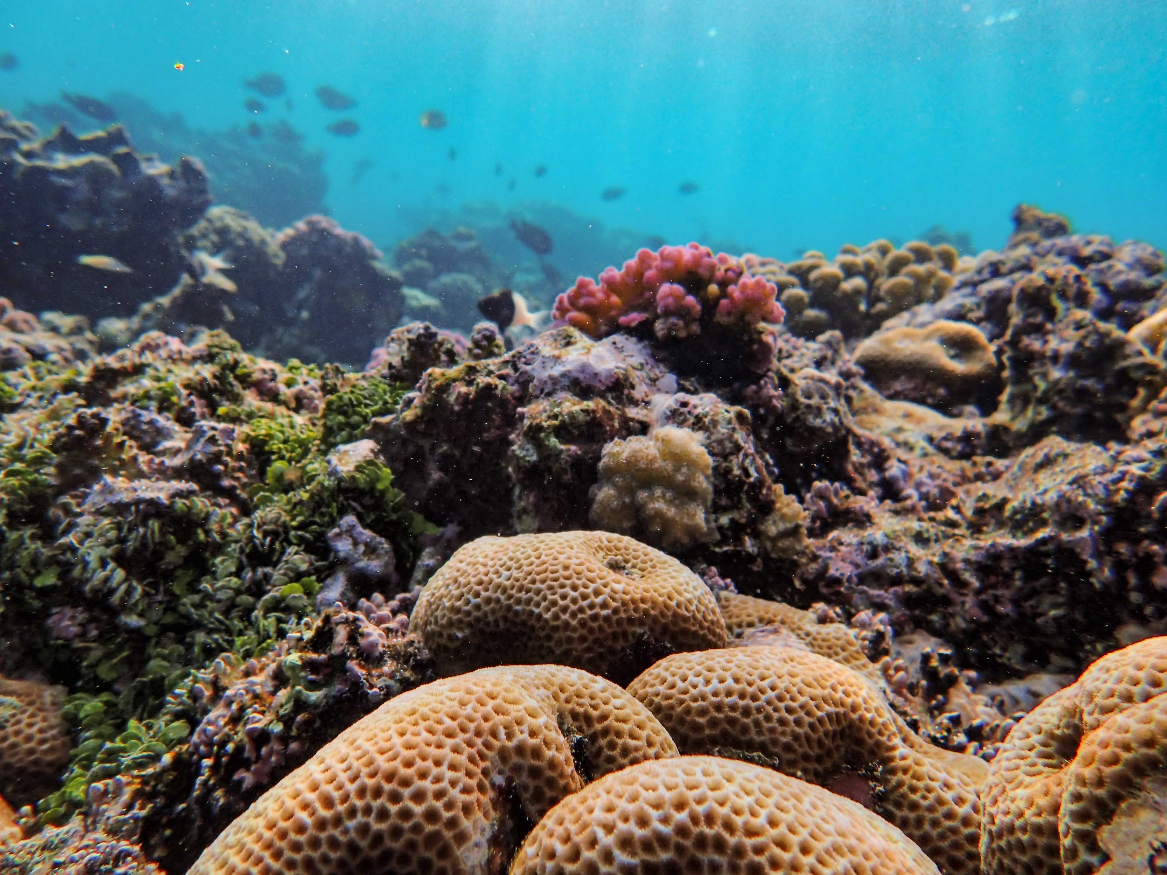
    After Hurricane Iris decimated the coral reef at Laughing Bird Caye National Park in 2001, many wrote off the UNESCO World Heritage site as a coral graveyard. But a small group from the coastal village of Placencia, Belize, about 18 kilometers (11 miles) from the island, saw hope. In 2006, the park had just 6% live coral cover. By 2023, it had reached approximately 60% — the result of the group planting more than 92,000 fragments of coral within the 1-hectare (2.5-acre) shallow fringing reef. The group, Fragments of Hope (FOH), is a Belize-based nonprofit organization focused on restoring coral reef habitats. Their work at Laughing Bird Caye is widely regarded as the best example of reef restoration in the Caribbean. But while the park stands as a beacon of hope for coral restoration, it has not been immune to the onslaught of record-breaking temperatures occurring globally. “2024 was the worst bleaching event since we’ve been recording around 2008,” Lisa Carne, FOH’s founder, said during an interview with Mongabay. Many of the corals planted at Laughing Bird have succumbed to extreme heat stress and disease. At Moho Caye, another restoration site, live coral cover dropped from more than 50% to less than 5%, “likely reflecting similar declines at Laughing Bird,” Carne said. It’s not just Laughing Bird and Moho. Unprecedented coral bleaching, a relatively new illness called stony coral tissue loss disease (SCTLD), and other threats to corals are negatively impacting reef health across Belize, and it forced FOH to shift tactics. “Over the past two years, it’s been getting hotter and hotter, and we haven’t been able to plant coral, which is what we would normally do,” Monique Vernon, a coral reef restoration practitioner trained by FOH who has been conducting restoration and monitoring activities with the group for years, told Mongabay. Instead, the group focused on conducting monitoring surveys and collecting data on the rate of coral bleaching and coral diseases at restored sites in Belize. “We’re trying to host two trainings per year so that we can get more Belizeans on board helping us to survey corals,” Vernon said. In March, when Mongabay spoke with her, Vernon was doing just that: serving as a trainer for a FOH workshop in Placencia to teach a group of Belizeans the basics of coral monitoring and data collection. This scientific effort is pivotal to identifying site variability and corals that show genetic resistance to stressors, according to Carne. She called these resilient corals “winners” and said finding them will inform future coral restoration and protection activities. FOH will eventually transplant fragments from these winners to sites with fewer stressors, with the hope that their proven resilience in harsher conditions will increase their chances of survival and growth. “We need to keep an eye on everything with monitoring,” Esther Peters, an expert on coral reefs and their diseases at George Mason University in Virginia, U.S., told Mongabay. “Often, there are not too many laboratories and not too many researchers. We need to bring in more people and get them involved and being able to report what they see to researchers,” said Peters, who has conducted research in Belize over the years and has recently been working close by, in Roatan, Honduras.

    Read more
    Aruba Tourism Authority Honoured with 2026 Aquila Whalesong Destination Award for Excellence in People Investment
    Tourism & Remote WorkAugust 20, 2026

    Aruba Tourism Authority Honoured with 2026 Aquila Whalesong Destination Award for Excellence in People Investment

    Aquila Center for Cruise Excellence has awarded the Aruba Tourism Authority (ATA) the 2026 Whalesong Destination Award for Excellence in People Investment, presented at Seatrade Cruise Global in Miami Beach this week. The award honors ATA’s exceptional leadership and long-standing commitment to sustainable, responsible and regenerative tourism through comprehensive capacity building across the island. For more than a decade, Aquila has worked alongside Aruba to support the destination’s evolution as a leader in cruise tourism excellence. Since 2016, this partnership has deepened through a coordinated, multi-year approach to strengthening collaboration across Aruba’s tourism ecosystem uniting port authorities, tour operators, retailers and public sector stakeholders around a shared vision for high-quality, people-centered experiences. “The Aquila Whalesong Award represents our deep appreciation for organizations that invest not only in infrastructure or marketing but in the human spirit behind tourism,” said Beth Hatt, Founder of Aquila. “The Aruba Tourism Authority exemplifies this ethos. The passion and commitment we have witnessed across their training initiatives are a true testament to the island’s leadership in sustainable tourism and world-class service excellence.” Through its partnership with Aquila, ATA has led a transformative journey to break down silos and foster stronger cross-stakeholder alignment across the destination. This has included ongoing service excellence and responsible tourism workshops, targeted coaching for tour operators, and multi-sector training initiatives designed to elevate both guest experience and community benefit. Operators such as De Palm, Fofoti, Pelican, and Kukoo Kunuku have translated these learnings into tangible product innovation enhancing storytelling, improving guest engagement and integrating more sustainable, locally rooted practices. The impact of these efforts has been significant. Participants overwhelmingly rated the training experience as valuable with strong endorsement of its practical application and collaborative approach. More importantly, operators have reported increased collaboration with local artisans and community partners, improved operational coordination and new business opportunities. Accepting the award on behalf of the Aruba Tourism Authority, Ronella Croes, Chief Executive Officer reflected on this milestone achievement: “This recognition is a powerful affirmation of Aruba’s belief that true destination excellence begins with people. By investing in our community, our partners and our shared values, we are shaping a tourism model that is sustainable, inclusive and deeply rooted in our identity.”

    Read more
    Hawaii Could See Its First Hurricane Landfall in Decades as Lala Strengthens
    Climate ActionAugust 20, 2026

    Hawaii Could See Its First Hurricane Landfall in Decades as Lala Strengthens

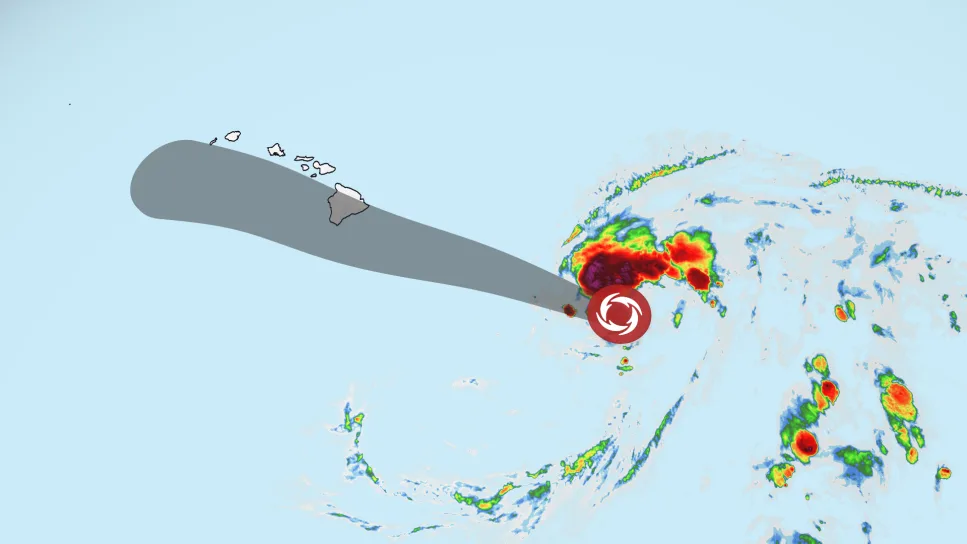
    Hawaii is bracing for a potential hurricane strike this weekend after Tropical Storm Lala’s forecast track shifted north, bringing the strengthening storm — and its heavy rain, damaging winds and dangerous surf — close to the Big Island. A hurricane warning is in effect for Hawaii County, meaning hurricane conditions are expected somewhere on the Big Island by this weekend. A tropical storm warning was issued for Maui County Friday morning, including the islands of Maui, Lanai, Molokai and Kahoolawe. A tropical storm watch was also issued for Oahu and Kauai counties. Lala had sustained winds of 65 mph Friday evening as it moved west-northwest about 260 miles southeast of Hilo, according to the National Hurricane Center. The latest forecast takes Lala near the Big Island on Saturday, raising the possibility of a rare hurricane landfall there. Even a slight shift in its path could determine whether the storm’s center crosses the island or narrowly passes to its south. Regardless, Lala will track close enough to bring strong winds and heavy rain onshore. Hawaii Gov. Josh Green declared a statewide emergency Thursday, allowing officials to activate the National Guard and access emergency funding as the state prepares for Lala. Ahead of the storm, officials in Maui County – where a flood watch is in effect through Sunday – identified temporary evacuation points residents could flee to if conditions worsen. “For Maui County, our main concerns are flash flooding, rapidly rising water in flood-prone areas, and power outages that could leave residents without electricity during the storm,” Mayor Richard Bissen said. “Secure your property, stock up on essentials, prepare for possible power outages, and check on kūpuna (elders), neighbors and loved ones.” Confidence in the exact track should improve through Friday, but there could still be changes as the storm approaches the islands and interacts with land, which can cause its center to wobble.

    Read more
    Cape Verde Launches First Sustainability Taxonomy to Channel Green Investment Into Energy and Water Resilience
    Green Finance & EconomyAugust 20, 2026

    Cape Verde Launches First Sustainability Taxonomy to Channel Green Investment Into Energy and Water Resilience

    The Bank of Cape Verde (BCV) has launched a public consultation on the country’s first sustainability taxonomy, establishing a new framework designed to guide investment towards environmentally sustainable activities in strategic sectors including energy and water. The initiative, which will remain open for public input until 10 August 2026, represents a significant step in Cape Verde’s efforts to strengthen climate resilience, improve sustainable finance standards and attract investment aligned with its long-term development priorities. The proposed taxonomy provides technical criteria for determining whether economic activities can be classified as sustainable. By creating a common framework for investors, financial institutions and policymakers, the system aims to reduce uncertainty around green investments and improve the allocation of capital towards projects that support climate mitigation, adaptation and resource efficiency. For Cape Verde, the development of a sustainability taxonomy carries particular importance given the country’s economic structure and environmental vulnerabilities. The Atlantic archipelago has significant potential in renewable energy, maritime industries and sustainable tourism, but remains highly exposed to climate-related pressures, including prolonged droughts, water scarcity, rising sea levels and extreme weather events. According to the Bank of Cape Verde, the taxonomy is intended to support the transition towards a low-carbon and climate-resilient economy by identifying activities that contribute positively to environmental and social objectives. The framework provides investors with clearer guidance on which projects qualify as sustainable, helping financial institutions incorporate environmental considerations into lending and investment decisions. The move reflects a broader global shift in sustainable finance, where governments and regulators are increasingly developing classification systems to prevent greenwashing and improve transparency in capital markets. Sustainability taxonomies have become important tools for aligning financial flows with climate and development objectives by establishing measurable standards for economic activities. Cape Verde’s first taxonomy is structured around seven key objectives: six environmental goals and one social development objective. These include climate change mitigation and adaptation, sustainable use and protection of water and marine resources, transition towards a circular economy, pollution prevention and control, protection of biodiversity and ecosystems, and social development. In the initial phase, the Bank of Cape Verde has prioritised detailed technical criteria related to climate change mitigation and adaptation. Other environmental objectives are addressed through the “do no significant harm” principle, requiring activities that contribute to sustainability goals to avoid creating substantial negative impacts in other environmental areas. This approach mirrors international sustainable finance frameworks, including those developed by major financial markets and institutions seeking to standardise environmental assessments. By adopting similar principles, Cape Verde is seeking to strengthen investor confidence and improve compatibility with international financing mechanisms. The development of the taxonomy has involved international cooperation, with technical support provided through the European Union’s Sustainable Finance Advisory Hub. The programme is implemented by the United Nations Development Programme (UNDP), with additional technical contributions from the Sustainable Finance Taxonomy Mapper.

    Read more
    How Is Climate Change Shaping Tropical Storm Lala?
    Climate ActionAugust 20, 2026

    How Is Climate Change Shaping Tropical Storm Lala?

    Researchers used to believe that Hawaiʻi island acted “like a rock in the stream,” and the winds controlling the movement of tropical storms had to go around it, according to retired University of Hawaiʻi professor Tom Giambelluca, who now oversees the islands’ Mesonet System of weather stations. While the island’s geography – with its 13,000-foot central mountains – does play a key role in protecting parts of the island, the reasons large storms have typically been broken up and slowed before they hit Hawaiʻi are varied and complex. This summer’s supercharged El Niño is largely what’s fueling Tropical Storm Lala, which is expected on Saturday to become the first hurricane to make landfall in Hawai‘i since Iniki in 1992. But scientists say residents should be ready for more storms in the years ahead as the effects of a warming planet take hold in the islands. “I often tell students that El Niño is like a practice run for climate change,” said Alison Nugent, an associate professor at the UH Department of Atmospheric Science, pointing at how climate change is likely to bring more warm temperatures even when the current El Niño cycle is over. In the past, relatively cool ocean temperatures and wind shear — or wind that comes from other directions and disrupts the storm — have both historically been important factors in preventing storms from hitting the islands at hurricane strength. A tropical storm becomes a Category 1 hurricane when winds reach 74-95 miles per hour. Now, as meteorologists have forecast Lala increasing in strength instead of dissipating like the vast majority of storms have in recent decades, it’s raising questions about the impact of climate change. Warmer ocean temperatures are definitely playing a role, Nugent said. Hurricanes get their energy from convection, or latent heat. “When you go from a high-energy state of vapor to a lower energy state of liquid, you release heat, and that heat is what fuels hurricanes,” she said. “With climate change, you have warmer oceans, and therefore the potential to get stronger storms.” Three of the five named storms that have made landfall in Hawai‘i over the last 67 years — Hurricane Dot in 1959, Hurricane Iniki in 1992, Tropical Storm Iselle in 2014, Tropical Storm Darby in 2016 and Tropical Storm Olivia in 2018 — have occurred in the last decade. Climate modeling done in 2016 predicted a significant rise in the number of hurricanes near Hawaiʻi in the coming decades. This year, the warmer-than-usual ocean temperature is playing an important role. If the ocean is below 79 degrees Fahrenheit, a hurricane doesn’t form. If the surface of the ocean hits 80 degrees, it’s a different story. On Thursday, the ocean surface to the south of the islands was between 80.6 and 82.4 degrees Fahrenheit. Exactly how climate change is fueling Lala isn’t entirely clear, however. That’s in part because El Niño — the ocean’s natural warming pattern, which occurs every four to seven years — is also causing significantly warmer temperatures this year. And while some scientists say there’s clear evidence that the climate’s overall warming patterns are supercharging El Niño, that’s still being debated within the scientific community. “The relationship between El Niño and climate change is not well-documented or understood,” said Steven Businger, a professor and former chair of UH’s Atmospheric Sciences Department.

    Read more
    How Japan’s Islands Preserve Nature and Culture for the Future
    Culture & CommunityAugust 13, 2026

    How Japan’s Islands Preserve Nature and Culture for the Future

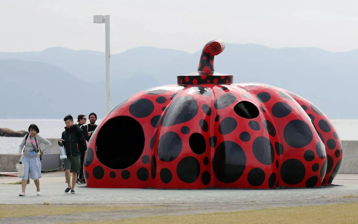
    Japan is home to more than 14,000 islands, each with its own distinct natural environment and cultural traditions. At the same time, these island communities face a shared challenge: sustaining local vitality. The stories of Hachijojima in Tokyo, where traditional culture continues to thrive; Naoshima in Kagawa Prefecture, known for its art-driven revitalization; and Yakushima in Kagoshima Prefecture, home to a UNESCO World Natural Heritage site, offer a glimpse into the efforts underway across Japan’s islands to preserve nature and culture while creating a sustainable future, JIJI Press reports. Hachijojima: Shaped by the Kuroshio Current Located about 290 kilometers south of central Tokyo and just a 55-minute flight away, Hachijojima is home to landscapes and cultural traditions distinct from those of Japan's mainland. In the island’s northwest stands Mount Hachijo-Fuji, rising 854 meters above sea level, while the surrounding Kuroshio Current has long brought abundant bounty from the sea. The island’s mild climate has earned it the nickname “the closest tropical destination to Tokyo.” From winter through spring, humpback whales migrate through its waters, and sea turtles and colorful tropical fish can be seen in the island’s exceptionally clear seas. However, Hachijojima’s appeal extends beyond its natural environment. During the Edo period (1603–1868), the island was also known as a place of exile, where a wide variety of people were sent, including Buddhist priests and samurai such as the once-powerful feudal lord Ukita Hideie. Over time, this history intertwined with the island’s environment and way of life, fostering a distinctive culture of its own. One of the most notable examples is Kihachijo, a traditional woven textile. Kihachijo traces its origins to silk textiles produced on Hachijojima some 800 years ago and has been designated a nationally recognized traditional craft. Its yellow, reddish-brown, and black colors are produced using natural dyes derived from small carpetgrass, Japanese bay tree bark, and a combination of Itajii chinkapin bark and mud dyeing. The process— from cultivating plants and producing dyes to coloring the fabric using the island’s soil and water—embodies the wisdom with which islanders have long made use of nature’s bounty. In recent years, a shortage of successors has become a challenge. In response, the Kihachijo Preservation Society and the Hachijo Town government have been working to pass on the craft’s techniques and nurture a new generation of practitioners, carrying this cultural tradition into the future. This knowledge of making the most of natural resources continues to shape life on the island today. Located along a common typhoon path, Hachijojima is not infrequently affected by disruptions to supplies and energy caused by canceled ships and flights. To address this, the island has made use of its abundant geothermal resources. In 1999, Japan’s first full-scale geothermal power plant on a remote island began operation there. At one point, it supplied roughly one-quarter of the island’s electricity and drew attention as a leading example of renewable energy use. Although the facility was decommissioned in 2019 due to aging equipment, surveys and plans for new geothermal power projects are still underway. Under the slogan “Aiming for a Clean Island,” Hachijo Town is working toward sustainable island development by making use of nature’s bounty in both cultural and energy initiatives. Naoshima: Revitalized Through Art Naoshima is a small island in the Seto Inland Sea with a population of around 3,000. Today, it is known as one of the world’s leading destinations for contemporary art, attracting visitors from across Japan and abroad. At Miyanoura Port, the island’s main gateway, visitors are greeted by Yayoi Kusama’s striking Red Pumpkin. Scattered across the island are the Chichu Art Museum, Benesse House Museum, and the Lee Ufan Museum, all designed by Tadao Ando. These sites create a unique landscape where nature, architecture, and art are seamlessly integrated. Among Naoshima’s many art experiences, the Art House Project stands out. Under this initiative, artists transform vacant traditional houses into works of art. At its core is the idea of making use of what already exists, rather than tearing down the old to build something new. The artworks extend beyond the buildings themselves. The light streaming through windows, the sea breeze flowing through alleyways, the pillars and floors marked by the passage of time, and even the everyday lives of the island’s residents all become part of the experience. As visitors walk around the island, they encounter its history and way of life firsthand. By preserving local memories while creating new appeal, the Art House Project is also an effort to rediscover the island’s value and pass it on to future generations. Yet Naoshima was not always a tourist destination. During Japan’s period of rapid economic growth, the Seto Inland Sea coast underwent industrialization, and the island experienced environmental problems such as air pollution caused by a copper smelter. In the 2000s, the island also played a role in treating industrial waste that had been illegally dumped on the neighboring island of Teshima. At the same time, it was losing population, and local vitality was beginning to decline. In the face of these challenges, Naoshima placed art at the heart of its regional revitalization. Today, the islands of the Seto Inland Sea—including Naoshima—host the Setouchi Triennale every three years. In 2025, the festival featured 222 artists and artist groups from 37 countries and regions, and Naoshima alone welcomed approximately 340,000 visitors. Once troubled by population decline, the island has become a cultural hub that attracts visitors from around the world. At the same time, the Seto Inland Sea is Japan’s largest enclosed coastal sea and faces the challenge of addressing the accumulation of marine plastic litter. In 2025, as part of the Setouchi Oceans X initiative, four prefectures jointly conducted coastal cleanup activities, collecting about 26 tons of waste. For Naoshima as well, preserving the environment of the Seto Inland Sea has become an important challenge as the island pursues regional revitalization through culture. Yakushima: Living in Harmony with the Forest Yakushima lies about 135 kilometers south of Kagoshima City and is one of the first sites in Japan to have been designated a UNESCO World Natural Heritage site. About 90 percent of the island is covered by forest, with mountains rising to nearly 2,000 meters. Subtropical plants grow along the coast, while cool-temperate vegetation is found near the mountain peaks, leading to the saying that “the Japanese archipelago exists within a single island.” Annual rainfall in the mountainous areas exceeds 8,000 millimeters—about five times Japan’s national average. This abundant rain has nurtured Yakushima’s unique ecosystem.

    Read more
    Giving Babies a Healthy Start in Turks and Caicos Islands
    Culture & CommunityAugust 13, 2026

    Giving Babies a Healthy Start in Turks and Caicos Islands

    Through early detection, integrated care, and sustained outreach, the Turks and Caicos Islands has eliminated mother-to-child transmission of HIV and hepatitis B. Dr. Camelia Clarke still remembers when a young mother came to the hospital just after missing her second period. Following a routine testing process, she tested positive for HIV. “We were able to counsel her, let her know what was happening. We also invited her partner in to be tested as well, and he was further linked to care and treatment,” Dr. Clarke recalls. What followed shows how early detection and immediate care can change the course of a newborn’s life, when a mother receives treatment and close monitoring throughout her pregnancy. “We established her baseline viral load, and with treatment, it eventually became undetectable,” Dr. Clarke says. By the time the mother gave birth with no complications, the team had dramatically reduced the risk of transmission. Right after delivery, the infant received prophylactic medication and, at 18 months, tested negative for HIV. “Because of the strong integrated service, the early recognition, we were able to prevent vertical transmission and have a healthy outcome for mother and baby,” Dr. Clarke explains. From early detection to zero transmission Today, Dr. Clarke is Director of the Health Promotion and Advocacy Unit and the focal point for the elimination of HIV mother-to-child transmission (EMTCT) within the Ministry of Health and Human Services in the Turks and Caicos Islands. The Caribbean nation, with just over 45,000 people, has been working for the better part of the last decade to build a system that strives to test, treat and monitor every woman and pregnancy. “Preventing mother-to-child transmission begins at the first antenatal visit,” says Nurse Savita Ramkellowan, Senior Public Health Nurse, attached to the Ministry of Health Primary Health Care. “The rapid tests have really transformed how we screen for HIV, syphilis, and hepatitis B in maternal health.” Thanks to this sustained effort, the World Health Organization (WHO) recently validated Turks and Caicos Islands for the elimination of mother-to-child transmission of HIV and hepatitis B. Backed by a strong primary health care system, integrated services ensure early detection, timely treatment, and continuous follow-up. By embedding screening into routine care, the country has reduced transmission rates below 2% and achieved over 95% coverage for prenatal care, HIV testing, and treatment for mothers and newborns.

    Read more
    Data Centre Could 'Transform Alderney's Economy'
    Connectivity & DigitizationAugust 13, 2026

    Data Centre Could 'Transform Alderney's Economy'

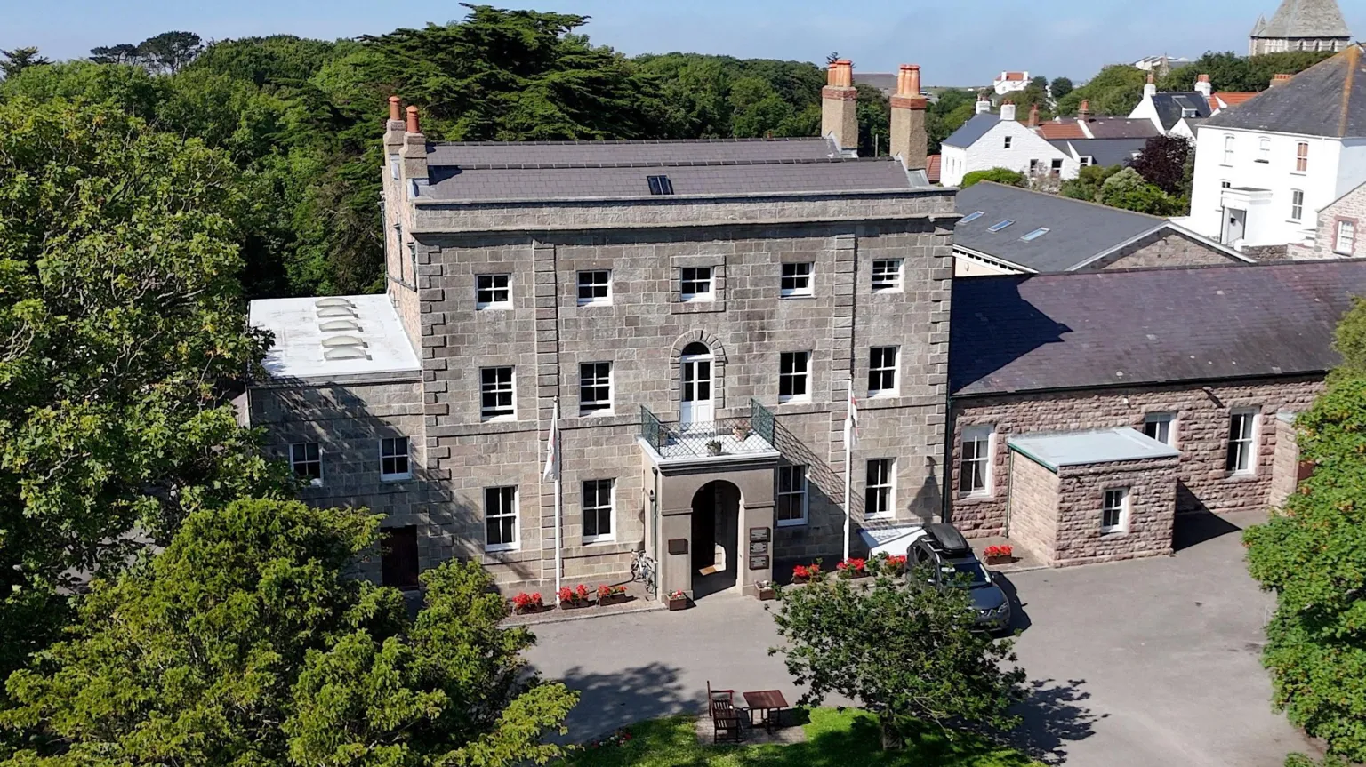
    A data centre could be "economically transformational" for Alderney, a study has found. The States of Alderney asked an independent company to carry out the research to see whether a centre could, in principle, be built and operate on the island. The feasibility study said the global data centre sector was experiencing "significant growth", driven by increasing demand for digital technologies such as cloud computing and artificial intelligence. The States said it now had a "duty" to consider plans for a data centre to see if there was any interest, but did not commit to a future development. "The feasibility study opens by saying a data centre is feasible and economically transformational for Alderney," said Jeannie Cameron, chair of the States' policy and finance committee. "We therefore have a fiduciary [a legal obligation to act in others' best interests] duty to consider it and to move to the next step to see what interest there is from the private sector, and to consult with the public when any proposals are received." The States added the data centre could raise "substantial income through leases and royalties", which could "significantly" exceed revenues from sources such as property tax and document duty.

    Read more